The Underwater Ruins in India’s Bay
Marine archaeologists haven’t fully explained the geometric stone structures lying beneath India’s coastal waters. Off Gujarat and Tamil Nadu, submerged formations defy conventional timelines of ancient civilizations. They’ve found carved pillars, precise alignments, and urban layouts that shouldn’t exist according to established history. Local fishermen have whispered about these ruins for generations, but science can’t agree whether they’re seeing lost cities or natural rock formations shaped by coincidence.
Introduction
What lies beneath India’s coastal waters has captivated archaeologists and historians for decades. Off Gujarat’s coast, the submerged city of Dwarka challenges conventional timelines of ancient civilizations. Marine archaeologists‘ve discovered stone structures, anchors, and pottery fragments dating back thousands of years in the Gulf of Khambhat.
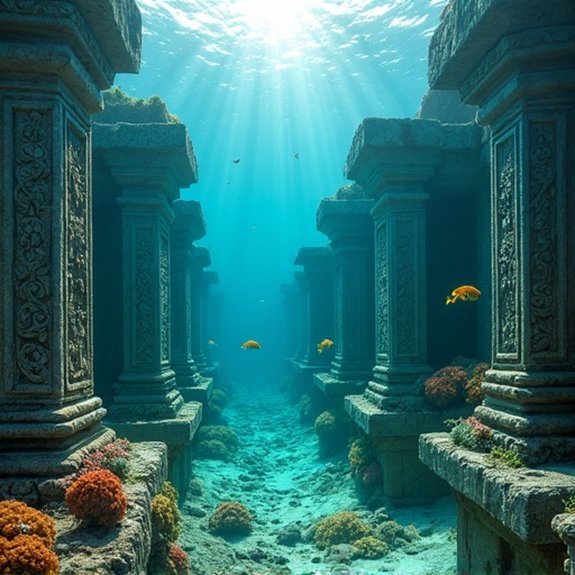
These underwater ruins aren’t limited to western India. Tamil Nadu’s coast holds equally mysterious remains near Mahabalipuram, where local legends‘ve long spoken of temples swallowed by the sea. Sonar imaging and diving expeditions’ve revealed geometric patterns, walls, and carved structures resting on the seafloor.
Scientists debate whether these sites’re victims of rising sea levels, tectonic activity, or catastrophic tsunamis. Carbon dating and archaeological evidence suggest some structures predate known Indian civilizations, forcing researchers to reconsider the subcontinent’s ancient history.
Ancient Tamil Maritime Legends
While modern archaeology confirms many underwater discoveries, Tamil literature’s preserved maritime legends about sunken lands for over two millennia. The Sangam texts describe Kumari Kandam, a vast landmass that supposedly connected India to Madagascar before catastrophic floods submerged it. These ancient poems detail seven vidanga lands and forty-nine territories that vanished beneath the waves.
Tamil scholars’ve documented stories of three successive Sangam academies, with the first two destroyed by oceanic deluges. The Silappatikaram epic mentions Poompuhar’s partial submersion, while the Manimekalai describes how the sea swallowed Puhar’s bustling port. Local fishermen still recount tales of temple bells ringing from beneath the waters during storms. These oral traditions’ve guided researchers to actual archaeological sites, suggesting the legends weren’t entirely mythical but contained kernels of historical truth about ancient coastal settlements.
Notable Cases or Sightings
Since marine archaeologists began systematic surveys in the 1980s, they’ve documented several remarkable underwater ruins along India’s coastline. The most significant discovery occurred in 2001 when India’s National Institute of Ocean Technology detected geometric structures nine meters underwater in the Gulf of Khambhat. Sonar images revealed what appeared to be city-like formations spanning five miles.
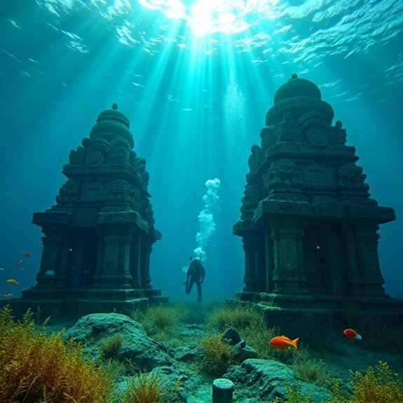
Off Mahabalipuram’s coast, divers found carved lion statues, temple walls, and granite blocks at depths of six to eight meters. Local fishermen had reported seeing temple tops during low tides for decades. In Dwarka, marine excavations uncovered stone anchors, walls, and bastions dating to 1500 BCE. Poompuhar’s submerged remains include brick structures and pottery fragments 23 feet below sea level. These findings’ve sparked debates about ancient sea levels and lost civilizations.
Common Theories or Explanations
Archaeologists and geologists’ve proposed several explanations for India’s submerged structures, ranging from natural geological processes to ancient urban settlements. Many experts believe the Gulf of Khambhat formations result from natural rock formations shaped by strong underwater currents and sediment deposits over millennia. The rectangular patterns could’ve formed through geological fracturing and erosion.
Others argue these structures represent remnants of the ancient Dwarka city mentioned in Sanskrit texts, submerged by rising sea levels around 9,000 years ago. Supporting evidence includes pottery shards and wood fragments carbon-dated to that period.
A third theory suggests they’re port installations from the Harappan civilization that sank due to tectonic activity. Scientists note the region’s seismic vulnerability makes catastrophic submersion plausible, though dating remains contested among researchers studying these enigmatic formations.
Frequently Asked Questions
Can Tourists Visit the Underwater Ruins Sites in the Bay of Bengal?
Tourists can’t directly visit the underwater ruins in the Bay of Bengal since they’re submerged. However, they can take boat tours above the sites, visit nearby museums displaying artifacts, and watch documentary footage of the structures.
What Equipment Is Needed to Explore These Submerged Structures?
Divers need specialized scuba gear, underwater cameras, and sonar equipment to explore these ruins. They’ll require diving certification, waterproof lights, and GPS devices. Archaeological teams also use remotely operated vehicles and side-scan sonar for deeper surveys.
Are There Any Ongoing Archaeological Excavations at These Underwater Locations?
Yes, archaeologists from India’s National Institute of Oceanography aren’t currently conducting major excavations, though they’ve periodically surveyed sites like Dwarka and Poompuhar. Limited funding and challenging underwater conditions have restricted continuous archaeological work recently.
How Deep Below the Surface Are These Ruins Located?
The ruins off Mahabalipuram lie at depths of 5-7 meters, while Dwarka’s structures sit 3-40 meters underwater. Poompuhar’s remains rest 19-23 meters deep. These varying depths reflect different submersion periods and geological conditions across sites.
What Preservation Efforts Are Being Made to Protect These Underwater Sites?
Archaeological teams’re conducting regular surveys and documentation using advanced imaging technology. They’ve established restricted zones to prevent looting, while marine biologists monitor coral growth impacts. Local authorities’re also developing underwater heritage tourism guidelines for sustainable access.

Did the Minoans Sail to the Americas?

What Was Found in the Copper Scrolls?