The Hidden Pyramids of Antarctica
Antarctica’s frozen landscape has yielded an unexpected mystery that’s captured global attention. Amateur researchers using Google Earth have identified massive pyramid-shaped structures buried beneath the ice, each measuring roughly one mile at their bases. While geologists point to natural erosion as the likely culprit, others aren’t convinced. These geometric formations have ignited fierce debate about what really lies hidden under Earth’s most remote continent.
Introduction
While satellite imagery and ground expeditions across Antarctica have revealed countless geological formations beneath the ice, several pyramid-shaped structures have captured the world’s attention and sparked intense debate among researchers. These angular formations, discovered through various mapping technologies, display remarkably uniform sides and distinct peaks that pierce through the continent’s frozen surface. They’ve generated competing theories about their origin, ranging from natural geological processes to more controversial explanations.
The structures’ geometric precision has drawn comparisons to ancient pyramids found in Egypt and Central America. Scientists, explorers, and theorists have analyzed photographic evidence, topographical data, and geological surveys to understand these formations’ true nature. Their remote location and harsh environmental conditions have limited direct investigation, leaving many questions unanswered about whether they’re products of unique glacial erosion patterns or something more extraordinary.
016 Google Earth Discovery
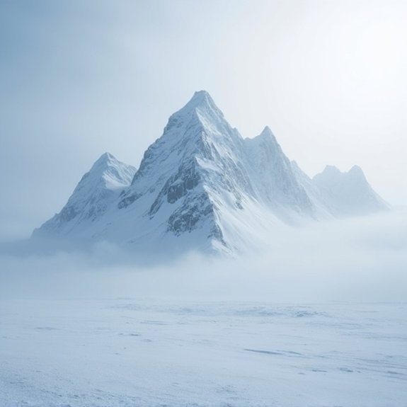
When amateur researchers began systematically scanning Antarctica through Google Earth in 2012, they identified what appeared to be four-sided pyramid structures emerging from the ice sheet. The satellite images revealed angular formations with distinct edges and symmetrical slopes, located approximately 10 miles inland from the coast. These structures measured roughly one mile at their base and displayed remarkably uniform geometry that seemed inconsistent with natural geological formations.
The coordinates quickly spread across internet forums, prompting thousands to examine the mysterious shapes themselves. Enhanced imaging tools allowed users to adjust contrast and brightness, revealing what they’d interpret as artificial construction. The most prominent structure exhibited four distinct faces converging at a central apex, while shadows suggested depth and dimensionality typical of pyramidal architecture.
Notable Cases or Sightings
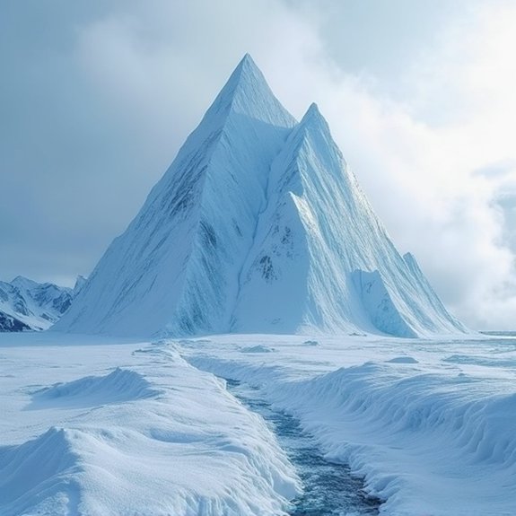
Aviation pilot Mark Daniels photographed triangular shadows casting from ice-covered mountains during a 2018 supply run. He’s maintained they’re artificial structures despite scientists attributing them to nunataks—exposed mountain peaks. Chilean researchers documented similar shapes in Queen Maud Land, fueling speculation about ancient civilizations. While mainstream geologists insist these are natural formations created by freeze-thaw erosion, witnesses remain convinced they’ve encountered something extraordinary beneath Antarctica’s ice.
Common Theories or Explanations
Proponents of the pyramid theory often point to three main explanations for these Antarctic formations. First, they suggest ancient civilizations built these structures before Antarctica’s glaciation, possibly connected to Atlantis or other lost cultures. Second, some theorists propose extraterrestrial involvement, claiming aliens constructed bases disguised as natural peaks.
The third explanation involves secret government operations. They argue world powers’ve hidden archaeological discoveries to suppress humanity’s true history. Skeptics counter these claims with geological evidence. They explain that pyramid-shaped mountains, called nunataks, form naturally through erosion and glacial processes. Wind patterns and freeze-thaw cycles carve triangular peaks that only appear artificial. Scientists note similar formations exist worldwide, including the Matterhorn. Most geologists dismiss the pyramid theory, attributing the shapes to coincidental natural weathering rather than intentional design.
Frequently Asked Questions
Are There Any Planned Scientific Expeditions to Investigate the Pyramid Structures?
No legitimate scientific expeditions are planned to investigate pyramid structures in Antarctica because they don’t exist. What some claim are pyramids are actually natural mountain formations called nunataks that’ve been shaped by millions of years of erosion.
What Equipment Would Be Needed to Properly Explore These Formations?
Researchers would need ground-penetrating radar, ice-core drilling equipment, thermal imaging cameras, and seismic sensors. They’d require extreme cold weather gear, satellite communication systems, and specialized mountaineering equipment to safely navigate Antarctica’s harsh terrain conditions.
How Do the Antarctic Pyramids Compare in Size to Egyptian Pyramids?
The Antarctic formations they’ve identified appear roughly comparable to Egypt’s Great Pyramid, with some estimated at 400-600 feet tall. However, thick ice coverage makes precise measurements impossible, and scientists haven’t confirmed they’re actually man-made structures.
What Are the Legal Restrictions for Visiting These Antarctic Locations?
Visitors can’t access these locations without permits from the Antarctic Treaty System. They’ll need environmental impact assessments, government authorization, and must follow strict preservation protocols. Most areas remain off-limits to tourists and require scientific justification.
Have Any Ground-Penetrating Radar Scans Been Conducted on These Structures?
No credible scientific expeditions have conducted ground-penetrating radar scans on these formations. They’re natural mountains shaped by erosion, not artificial structures. Geologists who’ve studied satellite imagery confirm they’re ordinary nunataks – exposed rocky peaks protruding through ice.

The Brick Temples of the Indus Valley

Stonehenge: Purpose Still Unknown