The Ancient Underwater City Off Cuba
In 2001, marine engineer Paulina Zelitsky’s sonar equipment detected something extraordinary 2,000 feet beneath Cuba’s waters—massive geometric structures that shouldn’t exist. Her team’s underwater cameras revealed what appeared to be pyramids, roads, and buildings stretching across the seafloor near the Guanahacabibes Peninsula. Scientists can’t agree whether they’re looking at natural rock formations or the remains of an ancient civilization that predates known history.
Introduction
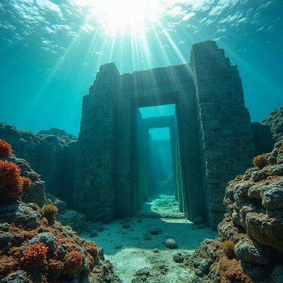
When marine engineer Paulina Zelitsky and her team were conducting sonar surveys off Cuba’s western coast in 2001, they weren’t expecting to find what appeared to be massive stone structures resting 2,000 feet beneath the Caribbean Sea. The sonar images revealed geometric formations spanning nearly eight square miles, including what looked like pyramids, roads, and buildings arranged in an urban pattern. Located near the Guanahacabibes Peninsula, these anomalies sparked intense debate among archaeologists, geologists, and oceanographers worldwide. Some researchers proposed they’d discovered remnants of an advanced prehistoric civilization, while skeptics argued the formations were natural geological features. The site’s extreme depth presented significant challenges for investigation, as it sits far below the limits of conventional scuba diving. Two decades later, the mystery remains unsolved.
Discovery in 2001
While searching for shipwrecks and mapping the ocean floor for a Cuban-Canadian joint venture, Paulina Zelitsky’s team from Advanced Digital Communications (ADC) stumbled upon the unusual sonar readings in May 2001. The side-scan sonar revealed geometric structures approximately 2,000 feet below the surface, west of Cuba’s Guanahacabibes Peninsula. The images showed what appeared to be massive stone blocks arranged in perpendicular and circular patterns, covering an area of two square kilometers.
The team couldn’t believe what they’d found. The formations resembled pyramids, roads, and buildings—structures that shouldn’t exist at such depths. Zelitsky, a marine engineer, noted the site’s location matched descriptions from ancient Maya and native Yucatecos oral histories about an island civilization that vanished beneath the waves.
Notable Cases or Sightings
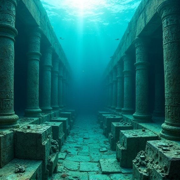
How did subsequent expeditions reveal more details about these mysterious structures? In 2002, Paulina Zelitsky’s team returned with advanced sonar equipment and a remotely operated vehicle (ROV). They’ve captured clearer images showing pyramid-like formations, circular structures, and what appeared to be roads connecting different areas. The ROV’s cameras recorded smooth, angular blocks resembling cut granite, some measuring up to five meters across.
National Geographic’s involvement brought credibility when they documented the site’s unusual geometric patterns. Marine geologist Manuel Iturralde examined the evidence and noted the structures didn’t match known geological formations. However, he’s remained cautious about their origin. The Cuban government’s restricted access to the area, limiting independent verification. Despite multiple requests, they haven’t allowed other research teams to conduct extensive studies, leaving many questions unanswered.
Common Theories or Explanations
What explanations have researchers proposed for these enigmatic structures? Scientists who’ve analyzed the sonar data suggest several possibilities. Natural geological formations remain the leading theory, with experts pointing to limestone’s tendency to fracture along geometric patterns when subjected to tectonic stress. Some geologists argue the site represents collapsed cave systems from when sea levels were lower during the last ice age.
Alternative researchers propose the structures could be remnants of a pre-Columbian civilization that existed before rising waters submerged the region approximately 12,000 years ago. They cite the precise angles and symmetrical arrangements as evidence of intelligent design.
Skeptics maintain that pareidolia—the human tendency to see patterns where none exist—explains why observers interpret natural rock formations as artificial structures. They emphasize that no conclusive archaeological evidence has emerged.
Frequently Asked Questions
What Specific Equipment Is Needed to Explore the Underwater Structures Safely?
Explorers need specialized submersibles, high-resolution sonar mapping systems, underwater cameras, diving suits rated for deep depths, decompression chambers, and remotely operated vehicles. They’ll also require boats with positioning systems and archaeological documentation equipment.
Are There Any Plans for Future Archaeological Expeditions to the Site?
There aren’t any confirmed future archaeological expeditions planned for the underwater structures off Cuba. The site’s remained largely unexplored since initial sonar discoveries, with funding limitations and political complexities preventing major research initiatives from moving forward.
Can Tourists Visit or Dive at the Underwater City Location?
Tourists can’t visit or dive at the site. Cuban authorities haven’t opened it for public access, and it’s located in deep waters requiring specialized equipment. The area remains restricted for potential future scientific research only.
What Is the Estimated Cost of Conducting Comprehensive Research at the Site?
Researchers haven’t published specific cost estimates for thorough exploration of the site. Deep-water archaeological investigations typically require millions of dollars for specialized equipment, submersibles, expert teams, and extended research periods at such challenging depths.
Which International Organizations Have Shown Interest in Studying These Formations?
No major international organizations have officially committed to studying these formations. Marine archaeologists and oceanographic institutes have expressed informal interest, but UNESCO and similar bodies haven’t launched formal investigations into the Cuban underwater structures.

Civilizations Erased by Natural Disasters

Could the Ark of the Covenant Still Exist?